

A cold front pushing through North and Central Texas today is expected to bring thunderstorms, some of which could become strong to severe—especially east of the I-35 corridor. Residents are encouraged to stay weather-aware and have multiple ways to receive warnings. Keep an eye on the skies as conditions may change quickly.
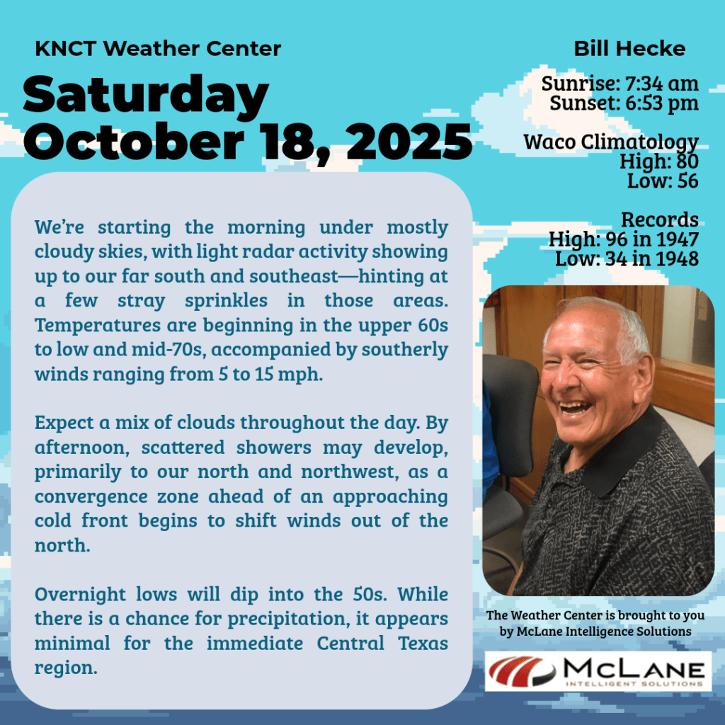
🌬️ Saturday’s Setup: Morning temperatures range from the upper 60s to mid-70s, with southerly winds at 5 to 15 mph. Radar shows light activity to the far south and southeast, suggesting a few stray sprinkles. Cloud cover will vary throughout the day, and by afternoon, scattered showers may develop to the north and northwest as winds begin shifting from the north.
🌤️ South Central Texas Outlook: It’s an unseasonably warm day across the Austin and San Antonio area. Highs will reach the mid-80s in the Hill Country and climb into the mid-90s along the I-35 corridor and Rio Grande Plains. Morning low clouds will give way to a partly sunny afternoon, with winds transitioning from the south/southwest to the west/northwest.
🌡️ Weekend Cool-Down: Following Saturday’s front, Sunday brings a brief but pleasant cool-down. Highs will settle in the 70s, with overnight lows dipping into the 50s and upper 40s. Monday morning will be the coolest start of the week, especially in the Hill Country.
🔥 Next Week’s Trends: Expect warm, dry conditions to return Monday through Wednesday, with highs back in the low 90s. Rain chances increase slightly late in the week, from Thursday to Saturday, but remain low (10–20%). Elevated grass fire risks are possible Monday and Tuesday afternoons, particularly west of I-35.
🌎 National Weather Service Outlook: Heavy rain and severe storms are forecast for the ArkLaTex, Mid-South, and Great Lakes regions through Sunday, with a squall line potentially sweeping the East Coast by Sunday night. Meanwhile, the Pacific Northwest and northern Rockies will turn colder and unsettled, with rain, mountain snow, and gusty winds. These shifts reflect an increasingly active pattern associated with the emergence of La Niña.
📻 Stay Tuned to KNCT FM 91.3 Alongside hourly weather updates, enjoy a stellar Saturday lineup:
| Program | Segment Title | Air Time |
|---|---|---|
| StarDate | Moon and Venus | 8:30am |
| The Senior Spotlight | Gary Emmert | 9:20am |
| EarthDate | (Re)Birth of the Amazon | 10:30am |
| Science and the Sea | Rogue Waves | 11:30am |
| Sock Hop Saturday Night | Bruce Vasbinder | 8:00pm |

Whether you’re tracking the skies or tuning in for great music and stories, KNCT is your companion for weather, wisdom, and weekend vibes.


