
Rain-free and warm conditions are expected to dominate the weather pattern across Central Texas this week, with afternoon highs ranging from the mid-80s to low 90s and overnight lows settling comfortably in the 60s. In the Austin and San Antonio area, residents can look forward to abundant sunshine and slightly above-normal daytime temperatures. Winds will be light, generally from the east at 5 to 10 mph.
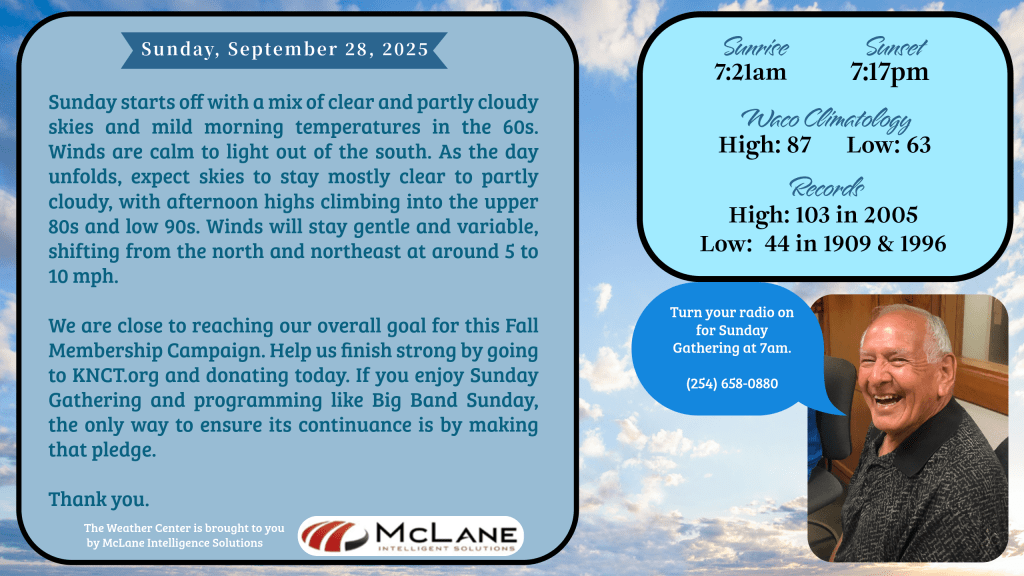
KNCT Meteorologist Bill Hecke reports that Sunday begins with a mix of clear and partly cloudy skies and mild morning temperatures in the 60s. Winds are calm to light out of the south, shifting to the north and northeast later in the day at 5 to 10 mph. Afternoon highs are expected to reach the upper 80s and low 90s under mostly clear skies.
Across the nation, the National Weather Service highlights several active weather zones. A stalled frontal boundary along the Southeast U.S. coastline continues to generate showers and thunderstorms, with localized flash flooding possible from the Carolinas to the Florida and Georgia coasts. Tropical Depression Nine is being closely monitored as it moves northward through the Bahamas, with potential development into a tropical storm or hurricane in the coming days.
Meanwhile, the Southwest remains under a flash flood threat today due to enhanced moisture and storm activity, particularly in south central New Mexico. Conditions are expected to dry out by Monday. In contrast, the northern and central Plains, Upper Midwest, Great Lakes, and Northeast will experience well above-normal temperatures, with highs running 10 to 20 degrees above seasonal averages.
Stay tuned to KNCT 91.3 FM for hourly weather updates and visit MyKNCT.com for on-demand forecasts and community coverage.