As families wrap up the long Labor Day weekend, much of Central and East Texas finds itself under a Flood Watch through 7 PM this evening, with South Central Texas remaining under alert until Noon Monday. Meteorologists are warning of multiple rounds of heavy rainfall, with totals ranging from 3 to 5 inches—and in some areas, up to 8 inches. The culprit: a nearly stationary frontal boundary stretching from southern Texas to the Gulf Coast, acting as a conveyor belt for slow-moving thunderstorms and downpours.
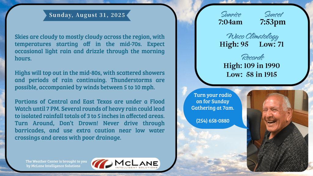
KNCT’s own Bill Hecke reports cloudy to mostly cloudy skies this morning, with temperatures in the mid-70s and intermittent drizzle. Afternoon highs will reach the mid-80s, but rain and thunderstorms will persist, driven by winds between 5 to 10 mph. The National Weather Service has issued a Slight Risk (Level 2 of 4) for excessive rainfall, citing the potential for flash flooding as storms repeatedly train over the same areas.
⚠️ Safety First: Officials urge residents to remember the life-saving mantra—Turn Around, Don’t Drown. Never drive through barricades, and use extreme caution near low water crossings and poor drainage zones.
🌡️ Looking Ahead: After Monday, rain chances will taper off briefly, allowing for slightly warmer and more stable conditions. Afternoon highs will hover in the 80s to low 90s, with morning lows in the 60s—near or just below seasonal norms. Rain chances return Thursday, with another round of showers possible next weekend.
Across the broader U.S., the eastern third remains dry and cool under high pressure, while the western states brace for rising heat as an upper-level ridge builds. Meanwhile, the central Plains and Missouri Valley continue to battle slow-moving storms and cooler-than-average temperatures.
🎙️ Stay tuned to KNCT 91.3 FM for updates from Bill Hecke and the Weather Team, and keep your mobile devices handy for alerts. Whether you’re on the road or at home, your safety is our priority.