As North and Central Texas wake to a cloud-streaked Friday morning, a slow-moving cold front is quietly reshaping the region’s weather story. From Dallas/Fort Worth to Waco and Killeen, isolated to scattered storms are expected to bubble up along and ahead of the front through the afternoon. While severe weather isn’t likely, brief heavy rain, frequent lightning, and gusty winds could make a noisy appearance.
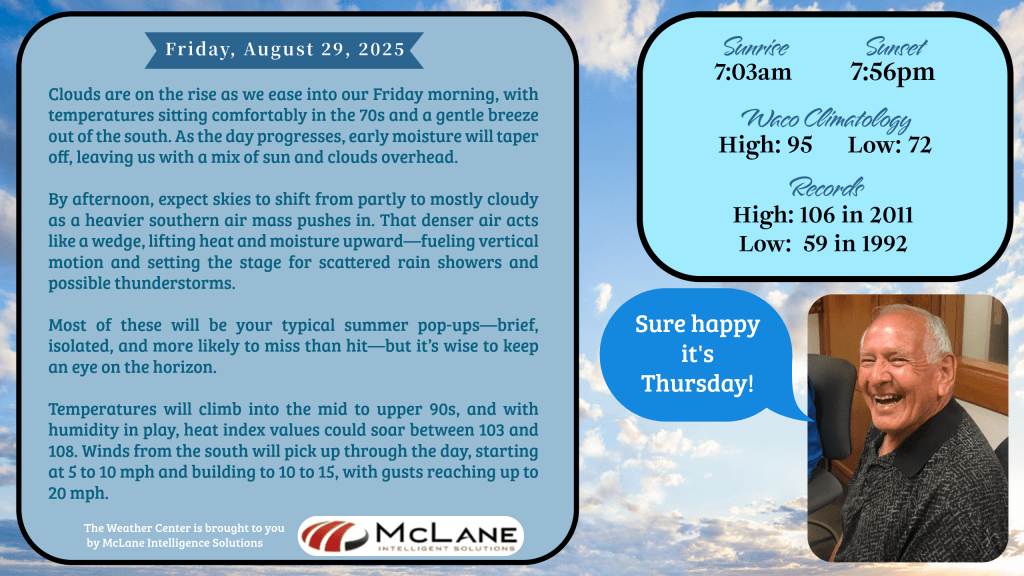
Temperatures will split across the front—cooler 80s to the north and east, while Central Texas holds onto the heat with highs in the mid 90s. That wedge of heavier southern air, as described by KNCT’s Bill Hecke in his morning update, is creating just enough vertical lift to stir up those classic summer pop-up showers. “More miss than hit,” Hecke noted, “but it’s wise to keep an eye on the horizon.”
🌧️ Weekend Outlook: Rain, Relief, and Readiness The active pattern won’t stop with Friday. Daily chances for showers and storms will continue through the Labor Day holiday, with the best chances arriving Saturday night into Sunday. Heavy rainfall is the main concern, especially in the Hill Country and southern Edwards Plateau, where isolated flash flooding could occur. Gusty winds may accompany stronger storms, but widespread severe weather remains unlikely.
Temperatures will trend cooler through the weekend, with highs settling into the 80s across much of the region. That’s a welcome break from the recent heat—but don’t let the cooler air fool you. Rain gear and backup plans are a must for any outdoor gatherings, travel, or holiday events.
🔥 South Texas Still Sizzles Meanwhile, Austin and San Antonio are holding onto summer’s grip. Highs today will range from the lower 90s to around 103 degrees, with heat index values climbing to 107—and briefly even 110 in some spots. If you’re spending time outdoors, stay hydrated, take breaks in the shade, and check in on neighbors who may be sensitive to the heat.
🌎 National Snapshot While Texas wrestles with heat and rain, a sweeping cold front is delivering fall-like weather to the Great Lakes, Ohio Valley, and Northeast. Highs in the 60s and 70s, lows in the 40s and 50s, and even a few 30s in colder pockets are expected. Across the Plains, Gulf Coast, and Southeast, slow-moving systems will bring rounds of downpours and flash flood potential through the weekend.
🎙️ Stay Connected Whether you’re tracking storms or planning a cookout, KNCT has your back. Tune in for updates from Bill Hecke and the weather team, and stream forecasts anytime at myKNCT.com. Remember: Turn Around, Don’t Drown. And keep your plans flexible—because Texas weather never plays by the rules.