As August winds down, North Texas finds itself in a tug-of-war between lingering summer heat and the first whispers of fall. A weak front continues to drift across the region today, stirring up isolated showers and storms with coverage expected to stay low. Highs will climb a few degrees, setting the stage for a steamy Thursday in the upper 90s.
But change is on the horizon.
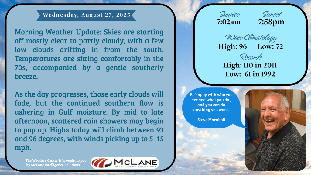
Meteorologist Bill Hecke kicked off the morning with a calm but cautionary tone: “Skies are starting off mostly clear to partly cloudy, with a few low clouds drifting in from the south. Temperatures are sitting comfortably in the 70s, accompanied by a gentle southerly breeze. As the day progresses, those early clouds will fade, but the continued southern flow is ushering in Gulf moisture. By mid to late afternoon, scattered rain showers may begin to pop up. Highs today will climb between 93 and 96 degrees, with winds picking up to 5–15 mph.”
That Gulf moisture will fuel additional rain chances north of I-20 late Thursday, as another cold front approaches. By Friday, cooler air will begin filtering into North Texas, bringing highs down into the 80s and scattered showers through Sunday. It’s a welcome break from the heat—and a preview of the seasonal shift ahead.
Further south, the Hill Country, I-35 corridor, and coastal plains will see scattered storms this afternoon, with highs ranging from the upper 80s to upper 90s. Thursday looks drier, but rain returns Friday into the weekend, with localized heavy downpours possible. Sunday promises cooler temps in the 80s for many areas, and that trend continues into midweek.
🌧️ National Perspective: According to the National Weather Service’s Short Range Public Discussion, flash flooding remains a concern in and near Idaho today. Heavy rainfall is expected across the southern and central Plains, stretching into the Mid-South through Thursday. Meanwhile, the Northwest continues to bake under above-normal temperatures, while much of the rest of the country cools down—some areas dipping more than 15 degrees below average. Record lows are possible across the Ohio Valley, Mid-Atlantic, and Northeast by Thursday morning.
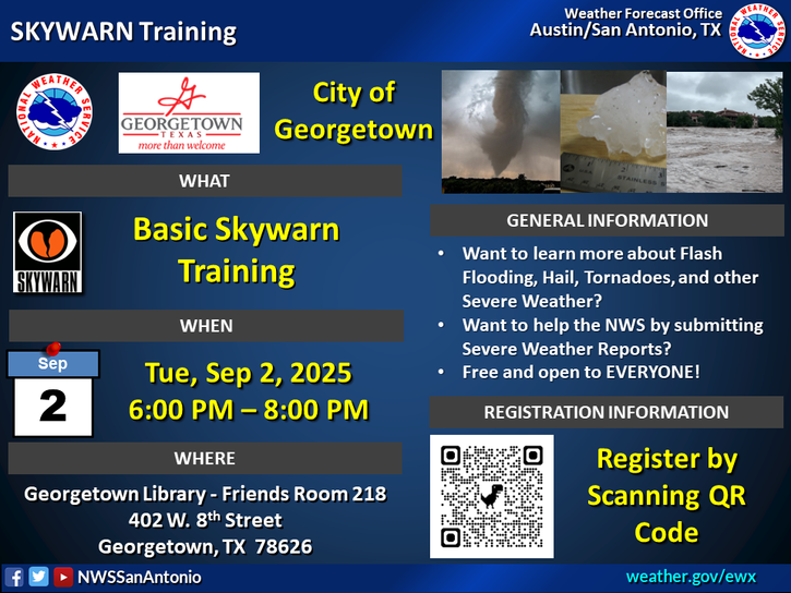
📍 Local Spotlight – Georgetown & Williamson County: For weather enthusiasts in the City of Georgetown and surrounding Williamson County, there’s a unique opportunity to get involved. A weather awareness and preparedness training session is being offered, where participants can learn how to report conditions directly to the National Weather Service. Seats are limited—scan the QR code and secure your spot today.
📻 Stay tuned to KNCT for hourly updates from Bill Hecke and visit myKNCT.com for forecasts on demand. Whether you’re tracking the next cold front or just planning your weekend, we’ve got your skies covered.