Today’s weather across Central Texas begins on a tranquil note, with mostly clear skies and morning temperatures in the low to mid-70s. KNCT’s meteorologist Bill Hecke reports a few cooler pockets dipping into the upper 60s, accompanied by gentle southeasterly winds that will build throughout the day. As warm, moist air from the Gulf begins to flow northward, expect some cloud development and rising humidity—setting the stage for a classic late-August heat surge.
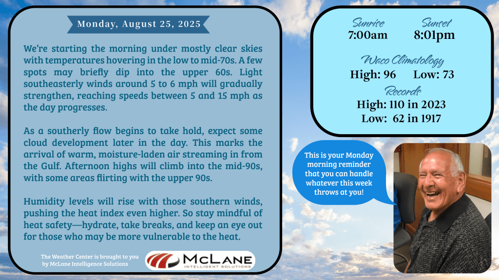
Afternoon highs will climb into the mid-90s, with some areas flirting with the upper 90s. That southern breeze will elevate the heat index, so listeners are reminded to stay hydrated, take breaks, and check on neighbors who may be vulnerable to the heat.
🌡️ Tonight’s Transition: A Front on the Move
Later tonight, a weak front will approach from the north. While most locations will stay dry with overnight lows in the low to mid-70s, a few showers and storms may pop up near the Red River, where the front’s influence is strongest. It’s a subtle shift, but one that opens the door to more unsettled weather in the days ahead.
⛈️ Tuesday & Wednesday: Spotty Storms, Slight Cooldown
Isolated storm chances linger Tuesday and Wednesday as the remnant frontal boundary stalls across the region. Temperatures will dip slightly below seasonal norms, with highs in the 80s to low 90s. For reference, DFW’s average high this time of year is 94°F, while Waco typically sees 96°F.
🌬️ Late Week: Another Front, More Rain
A second front is expected to arrive late in the week, bringing renewed rain chances through the weekend. Thursday may offer a brief warm-up into the mid to upper 90s, but temperatures will retreat again by Friday, settling back into the 80s and low 90s.
🌎 National Snapshot: Extremes on Both Ends
According to the National Weather Service, excessive rainfall remains a concern across the Southwest through Tuesday, with flash flooding possible in Colorado, Kansas, Oklahoma, and Arkansas through midweek. Meanwhile, the Pacific Northwest is locked in a dangerous heat wave, with temperatures near 100°F and little relief overnight. In contrast, areas east of the Rockies are experiencing a taste of early fall, with record lows possible in parts of the Midwest and Great Lakes.
📻 Stay Informed with KNCT
For hourly updates and expert insights, tune in to KNCT 91.3 FM or stream live at myKNCT.com. Bill Hecke will be tracking the front’s progress and keeping listeners ahead of the curve with timely forecasts and safety tips.