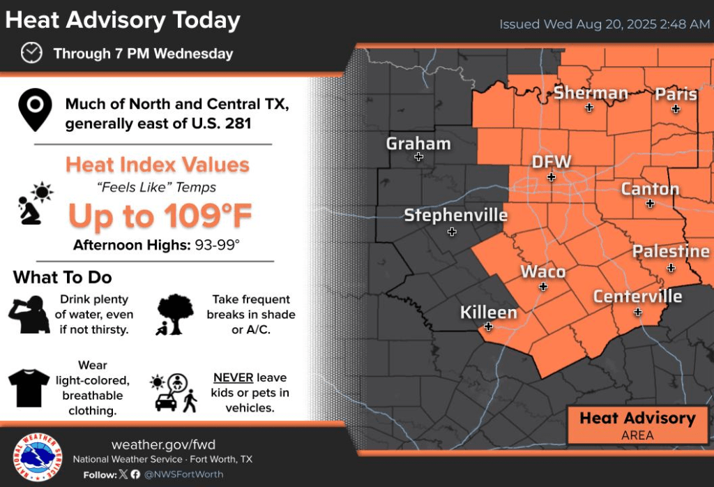
Wednesday greets Central Texas with a warm embrace—clear to partly cloudy skies and morning temps lounging in the 70s, stirred by a soft, variable breeze. But don’t let the calm fool you: a heat advisory is in effect as the day intensifies, with highs soaring into the mid to upper 90s and a heat index flirting between 105 and 110 degrees.
As the sun climbs, so do the chances for scattered showers—especially across southern and southeastern pockets. The real action, however, is expected later this afternoon, echoing yesterday’s rhythm of clustered showers and the occasional isolated thunderstorm. It’s a day to stay cool, stay hydrated, and keep your eyes on the sky.

And when it comes to staying informed, KNCT’s got your back. Tune in every hour for Bill Hecke’s expert weather updates, or catch them anytime on-demand at myknct.com/weather. Whether you’re planning your day or just seeking a moment of calm between the clouds, Bill’s forecasts are your trusted guide through Texas’ shifting skies.
Hurricane Erin Approaches: Coastal Communities Urged to Stay Alert
As of early Wednesday morning, Hurricane Erin continues its powerful march across the Atlantic, bringing with it a suite of serious hazards for coastal regions from the Bahamas to Atlantic Canada. The National Weather Service warns that life-threatening surf and rip currents will impact beaches along the U.S. East Coast, including North Carolina, throughout the week. Beachgoers are urged to heed lifeguard instructions and local advisories—this is not the time to test the tides.

The Outer Banks of North Carolina are bracing for storm surge flooding and tropical storm conditions beginning later today. Large waves are expected to cause significant beach erosion and overwash, potentially rendering some roads impassable. Southeastern Virginia may see similar conditions by Thursday.
Erin’s reach extends even farther: Bermuda is forecast to experience tropical storm conditions Thursday into Friday, and residents from the Mid-Atlantic to southern New England should monitor the storm closely as strong winds are possible through Saturday.
The National Hurricane Center emphasizes that while Erin’s exact path may shift, its impacts are already being felt—and will intensify. For the latest updates, visit the official Hurricane Erin page.


