
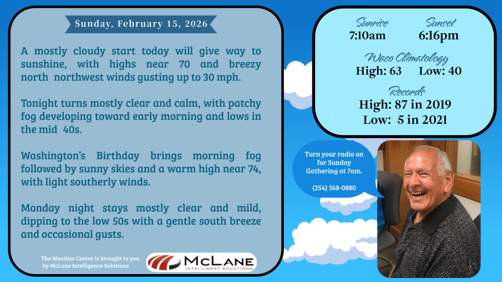
Central Texas begins the new week under a mix of clouds and sunshine, with a noticeable north–northwest breeze ushering in drier air. Mostly cloudy skies early today will gradually give way to partly cloudy conditions, and winds of 10 to 15 mph—gusting up to 30 mph—will keep the air feeling crisp despite afternoon highs climbing into the upper 60s and low 70s. By tonight, skies turn mostly clear with lows settling into the 50s. Patchy fog is expected to develop areawide toward daybreak.
The warm, quiet pattern will dominate the week ahead. Highs will surge into the 70s and 80s—running 10 to 20 degrees above what’s typical for mid‑to‑late February. With the warmup comes a growing fire weather concern: elevated fire danger is expected Tuesday across northwest counties, then again Wednesday and Thursday for areas near and west of I‑35 as dry air and periodic breezes return.
Across the Austin and San Antonio corridor, an upper‑level disturbance will bring partly cloudy skies today, while areas farther west enjoy full sunshine. Breezy northerly winds will continue, and temperatures will run 6 to 8 degrees above average for February 15th, ranging from around 70 to the lower 80s.
Nationally, the Weather Prediction Center highlights a dynamic setup across both coasts. In the Southeast, unsettled weather persists today as a surface low tracks northeastward. A Slight Risk for severe thunderstorms covers parts of northern Florida and Georgia, where damaging winds and a few tornadoes are possible. Heavy rain bands may also trigger localized flash flooding across portions of the Mid‑Atlantic and the Ohio/Tennessee Valleys.
Out West, an upper‑level trough is pushing onshore, bringing rounds of rain and high‑elevation snow to the Pacific Northwest, the northern Rockies, and especially the Sierra Nevada. Snow totals of 1–4 inches are expected through Monday, with heavier accumulations in the higher terrain. Central and Southern California face a Slight Risk for excessive rainfall on Monday as a strong coastal low enhances onshore flow—raising concerns for flash flooding, particularly near burn scars. Coastal Southern California may also see isolated severe thunderstorms with damaging winds.
While the West cools toward seasonal norms, much of the central and northern Plains will remain exceptionally warm, running 20–35 degrees above average through the next few days.
With warm, dry weather locked in locally and active systems on both coasts, Central Texas enters the week in a stable pattern—one that favors sunshine, above‑normal temperatures, and increasing fire weather concerns as February continues its spring‑like streak.


Leave a comment