Wednesday morning opens under a blanket of clouds, with skies ranging from cloudy to mostly cloudy and temperatures holding in the 60s. That cloud deck has trapped warmth overnight, while a southerly breeze of 5 to 15 mph adds to the humid feel. As the day progresses, those clouds will be slow to thin out, with moist air continuing to stream in from the south. Highs will reach the low to mid‑80s—slightly cooler than recent days—but humidity will remain high.
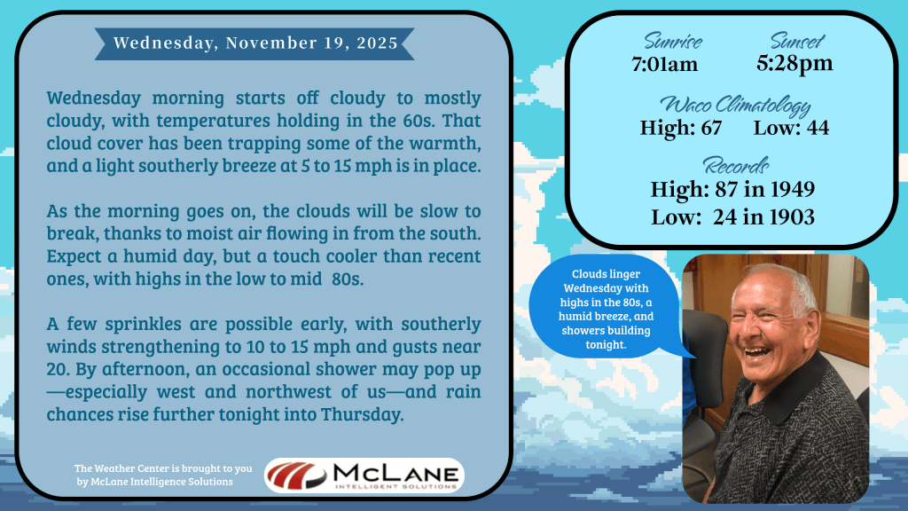
A few sprinkles may dot the morning commute, and winds will strengthen to 10 to 15 mph with gusts near 20. By afternoon, scattered showers are likely, especially west and northwest of the area. Rain chances rise further tonight, setting the stage for a stormy stretch.
According to the National Weather Service in Fort Worth/Dallas, storms will become widespread this evening and persist through the night, especially west of I‑35. A few strong storms cannot be ruled out, with gusty winds and isolated large hail possible. Locally heavy rain may also lead to minor flooding. The reminder is clear: never cross flooded roads.
Showers and storms will continue through Thursday, with bursts of heavy rainfall raising the risk of isolated flooding. Widespread totals of 1 to 2 inches are expected, with about 10% of North and Central Texas seeing up to 4 inches. Strong storms remain possible, capable of producing gusty winds.
Looking ahead, another storm system is expected Sunday into early next week. Heavy rain is possible, though timing and details are still being refined. Current guidance suggests rain tapering off by Thanksgiving. Travelers are urged to check the latest forecast at weather.gov.
From the Austin/San Antonio NWS, a Flood Watch is in effect from 12 AM Thursday through 6 AM Friday. Rainfall totals of 1 to 3 inches are expected, with isolated amounts up to 6 inches possible. The message is simple: Turn around, don’t drown.
Patchy drizzle this morning will give way to scattered showers and isolated thunderstorms this afternoon, with unseasonably warm highs in the upper 70s and 80s. Temperatures will gradually cool to late‑November averages as two storm systems move through—one Wednesday night into Friday morning, and another Sunday into Monday. Each system carries the potential for locally heavy rain, flooding, and strong to severe storms.
Nationally, the Weather Prediction Center highlights a Slight Risk of excessive rainfall over parts of the Southwest today and southern Texas Thursday. Heavy rain and thunderstorms will spread into the Southern Plains and Mississippi Valley by Thursday, with localized flash flooding possible. Meanwhile, higher‑elevation snow is expected across the Sierra Nevada and southern Utah mountains.
Locally, the City of Harker Heights has issued a weather threat briefing:
- Wednesday (Late Afternoon into Overnight): Marginal risk of severe storms, mainly isolated hail. Rain begins late afternoon, continuing overnight. Flash flood risk is low but present.
- Thursday: Higher flooding risk with widespread 1 to 2 inches of rain, and localized totals up to 4 inches. Urban and poor‑drainage areas may see rapid flooding.
- Weekend: A second storm system may bring additional heavy rainfall Sunday into Monday.
- Residents are urged to stay weather‑aware, clear drains and gutters where possible, and never drive through flooded roadways.
Stay tuned to KNCT for hourly weather updates and breaking news at the top of every hour from the Associated Press.