

As we step into Sunday morning, skies across Central Texas are partly to mostly cloudy, with temperatures resting in the low to mid-60s. A gentle southerly breeze at 5 to 10 mph sets the tone for what will be another unseasonably warm day.
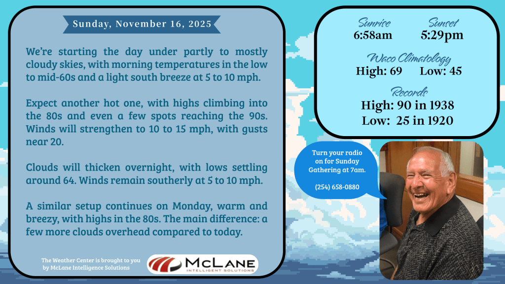
Expect the mercury to climb quickly, with highs soaring into the 80s and even a few spots touching the 90s. Winds will strengthen to 10–15 mph, gusting near 20, adding a touch of late-summer feel to this mid-November afternoon.
Clouds will thicken overnight, keeping lows mild around 64. Monday brings more of the same—warm, breezy conditions with highs in the 80s, though skies will carry a few more clouds than today.
The calm won’t last long. By Wednesday, an approaching storm system will usher in widespread showers and thunderstorms across North and Central Texas. Heavy rainfall and localized flooding are possible, with confidence growing in totals exceeding 2 inches through Friday. A few strong to marginally severe storms may develop midweek, though exact timing and location remain uncertain. This wet pattern looks to persist into Thanksgiving week, even as temperatures stay above normal for the next 10 days.
In the Austin and San Antonio corridor, today’s warmth is remarkable—even abnormally high for mid-November. Forecast highs are expected to challenge or break daily records. Morning fog and clouds will clear, leaving mostly sunny skies and light southerly winds. Record highs remain possible through Tuesday before rain chances return later in the week, accompanied by cooler, more seasonable air.
The National Weather Service paints a dynamic picture across the country:
- Southern California: Additional heavy rainfall Monday raises concerns for flash flooding and rock slides, especially in vulnerable areas like burn scars and coastal ranges.
- Northeast & Great Lakes: A wintry mix is on the way, with several inches of snow possible in higher elevations. Maine could see 4–9 inches with gusty winds, prompting Winter Storm Warnings.
- Texas & Southern Plains: Record-breaking warmth continues, with highs in the upper 80s to low 90s across major metros and the Rio Grande Valley.
- Mountain West & Plains: Thunderstorm chances increase early this week as a western storm system tracks eastward.
- Mid-Atlantic & Ohio Valley: Fire weather concerns emerge, with breezy post-frontal winds and low humidity creating conditions favorable for fire spread.
From snow in the Northeast to record warmth in Texas, the nation is experiencing a dramatic weather split. For Central Texas, the story is one of heat today, clouds tomorrow, and storms midweek. Stay weather-aware, especially as Thanksgiving approaches, with flooding and severe storms possible.
Keep it tuned to KNCT for hourly weather updates and the best Sunday lineup in Central Texas—your trusted source for music, community, and the forecast that keeps you prepared.


Leave a comment