Central and Southeast Texas awoke this Thursday to a veil of dense fog, with visibility plunging below a quarter mile in several areas. The National Weather Service issued a Dense Fog Advisory through 9 a.m., especially for communities east of the I-35 corridor near Austin and San Antonio. In these zones, the fog is not just a nuisance, it’s a hazard. Drivers are urged to reduce speed, increase following distance, and use low-beam headlights to safely navigate the morning commute.

☀️ Heat Builds Ahead of a Weekend Front
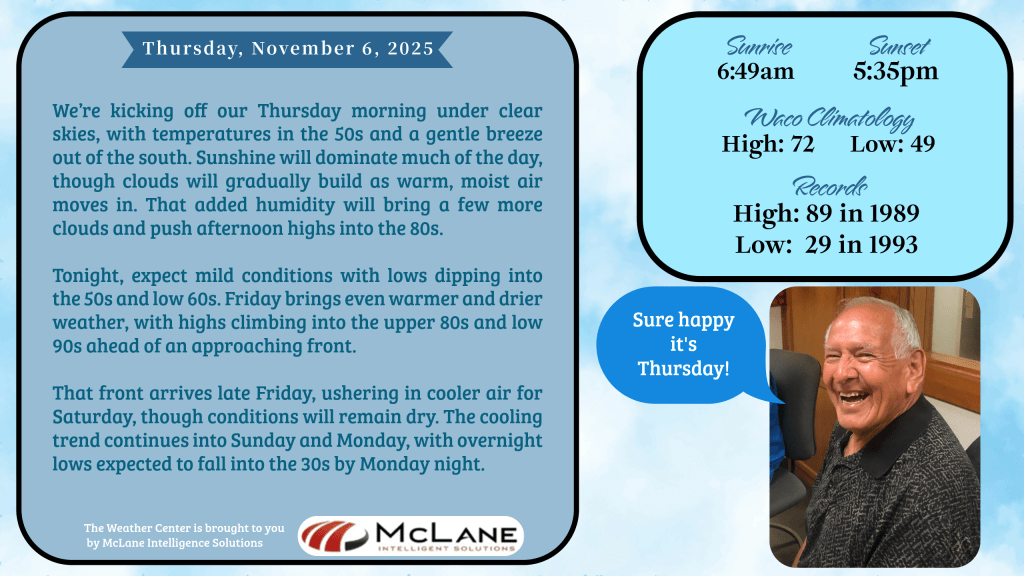
Once the fog lifts, South-Central Texas will bask in unseasonably warm sunshine. Temperatures today will climb into the 80s, carried by light south to southeast winds between 5 and 10 mph. This warm, moist air mass is setting the stage for a heat surge, with Friday and Saturday forecasted to flirt with daily record highs. Highs in the upper 80s to low 90s will run 5 to 15 degrees above seasonal averages, and no rainfall is expected.
Clear skies tonight will give way to patchy low clouds and renewed fog by morning, with overnight lows dipping into the 50s and near 60. The warmth will persist into Saturday, but change is on the horizon.
🌬️ Cold Front Brings a Sharp Turn
Late Saturday or early Sunday, a strong cold front will sweep through the region, bringing a dramatic drop in temperatures and a shift in conditions. Sunday’s highs will struggle to reach the 50s, and gusty winds will usher in dry air—raising concerns about wildfire spread, especially in grassy or drought-prone areas.
By Monday and Tuesday, the cold air will settle in, with lows falling into the 30s and 40s. Light freezes are possible in rural valleys and low-lying areas, marking the season’s first real taste of winter. The chill won’t last long, however; a gradual warming trend is expected to begin midweek, though dry conditions will continue.
📻 NOAA Radio Outage
For those relying on NOAA weather radio in the Austin area, be advised: the transmitter is currently off the air due to equipment issues. Technicians are working to restore service. In the meantime, KNCT will continue to provide hourly weather updates from Bill Hecke and breaking news from the Associated Press at the top of every hour.
🌎 National Weather Highlights
While Texas enjoys warm, dry conditions, the rest of the country is seeing more dramatic shifts. The Pacific Northwest is bracing for heavy rain and mountain snow from a fast-moving atmospheric river. The Upper Midwest will see a plunge in temperatures as Canadian air surges southward, setting the stage for a cold weekend.
Meanwhile, the Ohio and Tennessee Valleys may experience severe weather Friday, with the potential for large hail and gusty winds. Across the Northeast, cooler air will settle in behind a departing low, while new cold fronts sweep eastward, bringing showers and thunderstorms to the Great Lakes and Gulf Coast.
Stay tuned to KNCT for continuing coverage, safety updates, and listener tips. Whether you’re navigating foggy roads or preparing for the weekend cooldown, we’re here to keep you informed and safe.


