
South Central Texas remains under the influence of a stable high-pressure system, delivering a stretch of quiet, sun-filled days and crisp, clear nights through the end of the week. In the Austin and San Antonio corridor, daytime highs will reach into the 80s today, offering seasonable warmth and comfortable conditions. Light south to southeast winds at 5 to 10 mph will accompany the sunshine, while clear skies this evening may give way to patchy low clouds by morning. Overnight temperatures are expected to fall into the lower to mid-50s, setting the stage for another pleasant start on Thursday.
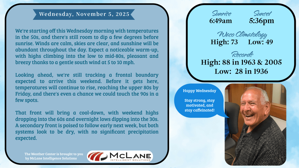
As the weekend approaches, temperatures will trend well above average, with Friday and Saturday potentially reaching near-record highs. Some locations across South Central Texas may flirt with the 90-degree mark, a notable contrast to the cooler pattern expected to follow. A cold front is forecast to sweep through the region Saturday night, bringing a shift in winds and a sharp drop in temperatures. Sunday will feel markedly different, with highs only in the 60s and overnight lows dipping into the 30s. Despite the dramatic temperature change, the front is expected to remain dry, with no rainfall anticipated. A secondary front may arrive early next week, reinforcing the cooler air mass but also lacking precipitation.
Across the broader United States, the National Weather Service highlights a more active pattern in the West and Northeast. In the Pacific Northwest and Northern California, a series of frontal systems—some tied to atmospheric rivers—are expected to bring periods of heavy rainfall through early Friday. Flash flooding remains a limited concern, especially in areas where terrain enhances precipitation totals. Coastal ranges will wring out moisture from these systems, while higher elevations in the Northern Continental Divide brace for accumulating snowfall.
Meanwhile, High Wind Watches are in effect for northern Montana, the northern Mid-Atlantic, and southern New England. Gusts exceeding 55 mph are possible as strong pressure gradients develop ahead of advancing systems. Thunderstorms may accompany these winds, particularly in the unstable post-frontal airmass over the Northeast this afternoon and evening. Some severe weather risk exists, especially where daytime heating interacts with cooler air aloft.
The central and southern tiers of the country—including the Southern Plains, Southeast, and Mid-Atlantic—will remain largely dry, with temperatures hovering near or above seasonal norms. In Texas, the warmth will be most pronounced Thursday and Friday, though few locations are expected to break records. Downslope winds off the Rockies and Appalachians will contribute to breezy, dry conditions, elevating fire weather concerns near the Virginia/West Virginia border and along the New Mexico/Texas line. However, the lack of critically dry fuels may help limit the overall fire threat.
Looking ahead, the general flow pattern across the Lower 48 begins zonal, with west-to-east winds dominating the upper levels. By Friday morning, a broad upper-level trough is expected to develop near the Mississippi Valley, helping to steer moisture into the Northwest and maintain dry conditions across much of the interior and southern U.S.
Locally, KNCT FM will continue to provide hourly weather updates and top-of-the-hour news from the Associated Press, keeping listeners informed as the weekend front approaches and temperatures take a seasonal turn.