
Dry and comfortable weather is expected to continue through Sunday night across much of the southern and central United States, following the passage of Saturday’s cold front. Afternoon temperatures will range from the mid-60s to mid-70s, with overnight lows dipping into the 40s. In the Austin and San Antonio area, Sunday will be cooler, with highs in the upper 60s to lower and middle 70s.
A strengthening ridge of high pressure aloft is forecast to bring a steady warming trend through the upcoming week. By Wednesday, many locations may see high temperatures reach near 80 degrees, with readings running 5 to 15 degrees above seasonal averages. Overnight lows will generally remain in the 50s, and no rainfall is expected during this period.
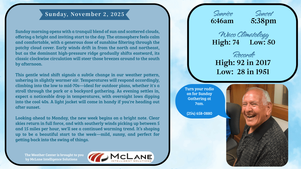
November typically ushers in cooler and drier conditions compared to October, with an increase in cold front activity. Average highs tend to decline from the upper 70s into the 60s, and lows in the 50s often mark the arrival of the first widespread freeze. However, the current outlook for November 2025 suggests warmer and drier than normal conditions for much of the region.
Looking ahead, temperatures are expected to climb from the low to mid-70s on Sunday to the mid-to-upper 80s by late next week. The forecast remains largely rain-free from Sunday through the start of the weekend.
Nationally, the Weather Prediction Center reports unsettled weather persisting across the Northwest and northern Rockies into Sunday, with strong winds prompting High Wind Warnings in Montana. A brief lull in precipitation is expected late Sunday before another system brings rain back to the region early in the week.
Elsewhere, temperatures will moderate across the Plains, Midwest, and parts of the Appalachians following a frosty start to Sunday. A zonal flow pattern is expected to develop, promoting more seasonable conditions by Tuesday. Elevated fire weather concerns are noted for portions of Montana, Wyoming, Colorado, and Nebraska due to dry and windy conditions.
Rain is forecast to spread into the Great Lakes late Sunday and into the Northeast by Monday, while a slow-moving upper-level system brings showers and thunderstorms to the Southeast and Mid-Atlantic. Snow may mix in at higher elevations of the northern Appalachians early Tuesday.
Overall, the start of November brings a mix of tranquil and active weather across the country, with the southern tier enjoying a stretch of mild, dry days.