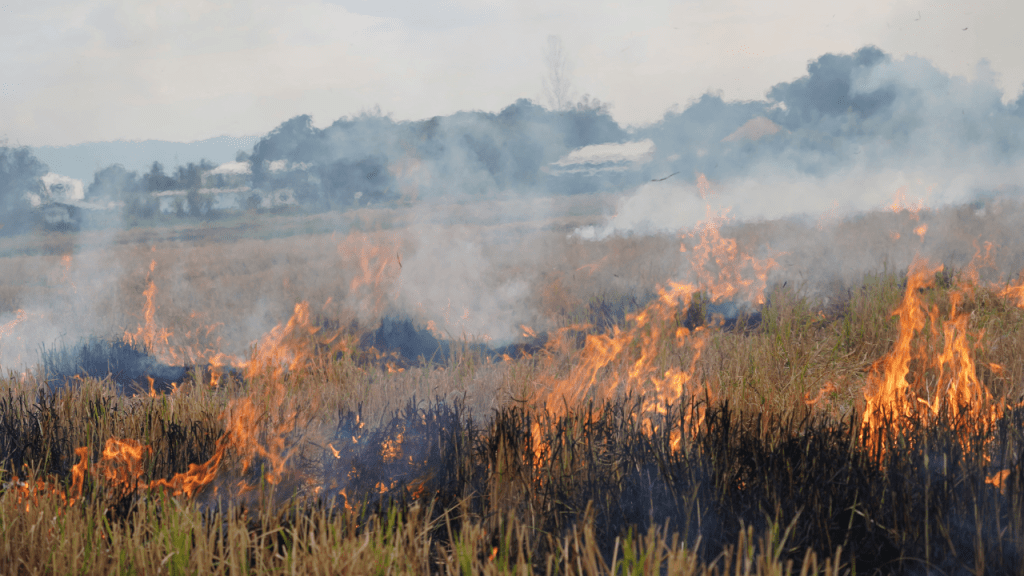
Austin Water’s Wildland Conservation Division will carry out a prescribed burn today across approximately 190 acres of the Water Quality Protection Lands (WQPL), a vital step in restoring native grasslands and safeguarding Central Texas’s water supply.
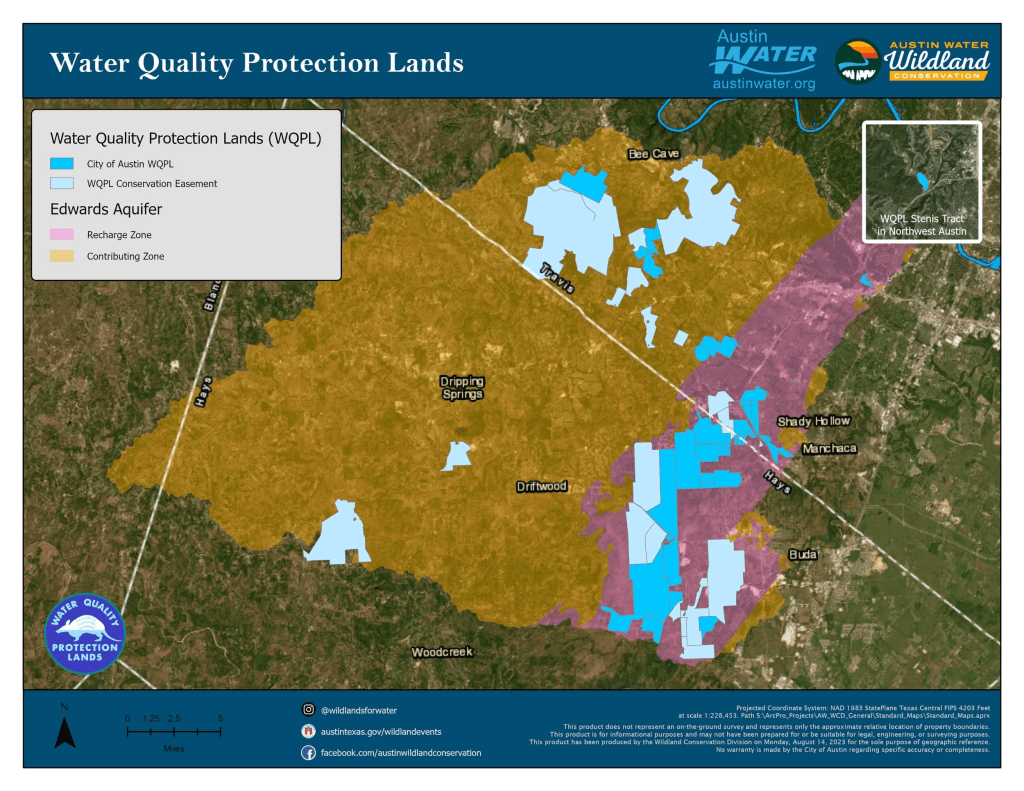
From 10am until sunset, smoke may be visible northeast of RR 3237, north of FM 150, south of FM 967, and west of FM 1626 and FM 2770. Visibility may also extend along the I-35 corridor between South Austin and Kyle, and westward toward Dripping Springs and Wimberley.
Prescribed burns are a time-tested ecological tool that mimic natural fire cycles. They reduce invasive brush, promote native grasses, and enhance biodiversity. According to Matt Lore of Austin Water’s Wildland Conservation Division, “Prescribed burns improve the resiliency of our land when they are used as a planned seasonal management tool.”

The WQPL program manages over 35,000 acres to protect the Edwards Aquifer, which supplies water to Barton Springs and wells throughout Hays and Travis Counties. After burns, wildflowers flourish, native grasses rebound, and grassland birds like quail and northern harriers find ideal nesting and feeding grounds.
The burn will be conducted by a team of highly trained professionals from Austin Water, local fire departments, and state and federal land agencies. Each participant meets rigorous standards for training, fitness, and protective gear. Burn plans are tailored to weather conditions, including wind and recent rainfall, to ensure safe and effective fire behavior.
Austin Water provides public notifications before each burn, including maps and updates. Interested residents can sign up for alerts at this link and follow updates on Facebook and X (formerly Twitter).